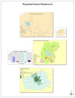
Using ArcGIS was definitely a learning experience. Most of the program features were inherently understood because of general familiarity with other computer programs. The ability to map different causes and effects of expanding an airport was very enlightening. There were definitely more effects of expanding an airport than I originally thought, so this exercise was definitely useful.
One of the largest benefits of using ArcGIS is developing the big picture: discovering the connections between originally unique subjects. For example, seeing the effect an airport expansion will have on schools within the noise contour or land usage surrounding the airport. ArcGIS gives users and viewers so much information in one location so planning and decision making can take place. These decisions can now be made on topics such as economy, environment, and population simultaneously rather than just focusing on one topic and neglecting other effects. Without the program there would be several paper maps that could not be viewed together at once making updating and decision making significantly more difficult.
The primary downfall of ArcGIS is learning the program. Going through the walkthrough the first time had absolutely no learning value to it; it was simply going through the motions to complete the assignment. Program functions were understood a little more after the second walkthrough and by the third walkthrough it was very comfortable. However, everything was given to us when we used ArcGIS for this assignment (i.e. land plots), we didn't need to develop any ourselves. Furthermore, we have only used the program functions in a narrow set of circumstances so we still don't know everything the program is capable of.
Other downfalls of ArcGIS involve users. This program is available to such a wide range of people, so data and conceptual models can be skewed. ArcGIS is so expansive that errors aren't uncommon. This raises questions. Is this data valid? How can maps maintain uniformity with such a large user base? When used in small groups, interpretation and data checking aren't major issues. However, used on a larger scale where multiple agencies or populations are contributing towards a common goal, there is significant room for error.
No comments:
Post a Comment